Congressional district · Boundaries of the 119th Congress
Nebraska's 3rd district
Nebraska's 3rd district has 652,995 residents on 69,614 mi² of land. It is represented by Adrian Smith (R-NE-3). Federal contract obligations attributed to it reached $162.3M in FY2026.
- Residents
- 652,995
- Land area
- 69,614 mi²
- Counties
- 80
- Representative
- Adrian Smith
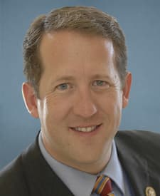
Members for this district
Members who held this seat while these boundaries were in force, newest first.
Senators
The state's senators today, or on the last day of these boundaries for an older plan.
 Deb FischerR-NE
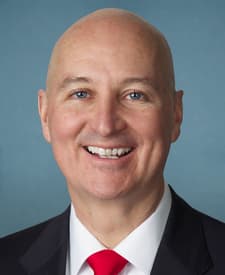 Pete RickettsR-NE
Counties
Share of the district's residents living in each county, and share of the county's residents living in the district (2020 census tracts weighted by their overlap).
- Hall County9.6% of the district · 100% of the county
- Buffalo County7.7% of the district · 100% of the county
- Scotts Bluff County5.5% of the district · 100% of the county
- Lincoln County5.2% of the district · 100% of the county
- Adams County4.8% of the district · 100% of the county
- Dawson County3.7% of the district · 100% of the county
- Gage County3.3% of the district · 100% of the county
- Dakota County3.3% of the district · 100% of the county
- Washington County3.2% of the district · 100% of the county
- Otoe County2.5% of the district · 100% of the county
- Saline County2.2% of the district · 100% of the county
- York County2.2% of the district · 100% of the county
- Box Butte County1.6% of the district · 100% of the county
- Red Willow County1.6% of the district · 100% of the county
- Custer County1.6% of the district · 100% of the county
- Holt County1.5% of the district · 100% of the county
- Wayne County1.5% of the district · 100% of the county
- Cheyenne County1.5% of the district · 100% of the county
- Hamilton County1.4% of the district · 100% of the county
- Phelps County1.4% of the district · 100% of the county
- Knox County1.3% of the district · 100% of the county
- Cedar County1.3% of the district · 100% of the county
- Keith County1.3% of the district · 100% of the county
- Dawes County1.2% of the district · 100% of the county
- Richardson County1.2% of the district · 100% of the county
- Merrick County1.2% of the district · 100% of the county
- Pierce County1.1% of the district · 100% of the county
- Jefferson County1.1% of the district · 100% of the county
- Nemaha County1.1% of the district · 100% of the county
- Burt County1.0% of the district · 100% of the county
- Kearney County1.0% of the district · 100% of the county
- Thurston County1.0% of the district · 100% of the county
- Howard County1.0% of the district · 100% of the county
- Antelope County1.0% of the district · 100% of the county
- Clay County0.9% of the district · 100% of the county
- Dixon County0.8% of the district · 100% of the county
- Fillmore County0.8% of the district · 100% of the county
- Cherry County0.8% of the district · 100% of the county
- Boone County0.8% of the district · 100% of the county
- Johnson County0.8% of the district · 100% of the county
- Sheridan County0.8% of the district · 100% of the county
- Thayer County0.8% of the district · 100% of the county
- Furnas County0.7% of the district · 100% of the county
- Morrill County0.7% of the district · 100% of the county
- Nuckolls County0.6% of the district · 100% of the county
- Valley County0.6% of the district · 100% of the county
- Chase County0.6% of the district · 100% of the county
- Polk County0.6% of the district · 69% of the county
- Webster County0.5% of the district · 100% of the county
- Nance County0.5% of the district · 100% of the county
- Kimball County0.5% of the district · 100% of the county
- Sherman County0.5% of the district · 100% of the county
- Brown County0.4% of the district · 100% of the county
- Harlan County0.4% of the district · 100% of the county
- Franklin County0.4% of the district · 100% of the county
- Perkins County0.4% of the district · 100% of the county
- Hitchcock County0.4% of the district · 100% of the county
- Frontier County0.4% of the district · 100% of the county
- Pawnee County0.4% of the district · 100% of the county
- Greeley County0.3% of the district · 100% of the county
- Gosper County0.3% of the district · 100% of the county
- Deuel County0.3% of the district · 100% of the county
- Garden County0.3% of the district · 100% of the county
- Dundy County0.3% of the district · 100% of the county
- Garfield County0.3% of the district · 100% of the county
- Boyd County0.3% of the district · 100% of the county
- Rock County0.2% of the district · 100% of the county
- Sioux County0.2% of the district · 100% of the county
- Wheeler County0.1% of the district · 100% of the county
- Hayes County0.1% of the district · 100% of the county
- Keya Paha County0.1% of the district · 100% of the county
- Logan County0.1% of the district · 100% of the county
- Banner County0.1% of the district · 100% of the county
- Hooker County<0.1% of the district · 100% of the county
- Grant County<0.1% of the district · 100% of the county
- Loup County<0.1% of the district · 100% of the county
- Thomas County<0.1% of the district · 100% of the county
- Arthur County<0.1% of the district · 100% of the county
- McPherson County<0.1% of the district · 100% of the county
- Blaine County<0.1% of the district · 100% of the county
Federal contracts
Contract obligations attributed to the district by each action's county and its award's ZIP code (land shares through census tracts); an estimate where ZIP codes cross district lines.
- Obligations · FY2026
- $162.3M
- Per resident
- $249
- Rank in Nebraska
- 2 of 3
- Contract actions
- 6,979
- New awards: 6,050
By fiscal year
- 134.6MFY2017
- 107.7MFY2018
- 144.4MFY2019
- 204.9MFY2020
- 228.4MFY2021
- 196.8MFY2022
- 240.3MFY2023
- 285.2MFY2024
- 235MFY2025
- 162.3MFY2026
Top buyers
- Department of the Army$58.1M36%Department of Defense
- Agricultural Marketing Service$26.5M16%Department of Agriculture
- Department of State$22.6M14%
- Defense Logistics Agency$12.4M7.6%Department of Defense
- Department of Veterans Affairs$7.8M4.8%
- Forest Service$6.9M4.2%Department of Agriculture
- Department of Homeland Security
- Agricultural Research Service$5.2M3.2%Department of Agriculture
Top recipients
- HENDRICKSON TRANSPORTATION LLC$43.7M27%1 award
- HCI MANAGEMENT SERVICES COMPANY$16M9.8%9 awards
- NEBRASKA BEAN, INC.$12.3M7.6%13 awards
- HORNADY MANUFACTURING COMPANY$11.6M7.2%96 awards
- APTIM FEDERAL SERVICES, LLC$8.5M5.2%1 award
- KELLEY BEAN CO INC$6.8M4.2%7 awards
- ALL NATIVE SYNERGIES COMPANY$6.6M4.0%3 awards
- 4,790 awards
- CARGILL MEAT SOLUTIONS CORPORATION$3.3M2.0%4 awards
- GRAIN CRAFT CORN, LLC$2.9M1.8%6 awards
Other boundaries
District lines change between plans; each plan keeps its own page.
Sources and method
Every figure on this page traces to these records.
- Congressional district boundaries and relationship files (U.S. Census Bureau)U.S. Census Bureau, Cartographic Boundary Files (congressional districts) and 2020 relationship files · release cd116+cd118+cd119 · loaded Oct 3, 2026 · license: Public domain (U.S. Government work, 17 U.S.C. § 105)
- Members of Congress, their terms, committees and identifiers (The @unitedstates project (from the Biographical Directory of the U.S. Congress, the House and the Senate))unitedstates/congress-legislators: legislators, committees and current committee membership · data current to Oct 3, 2026 · loaded Oct 3, 2026 · license: CC0 1.0 (public domain dedication)
- ZIP code (ZCTA) to congressional district crosswalk (U.S. Census Bureau)U.S. Census Bureau, 2020 relationship files (ZCTAs, tracts and congressional districts); shares computed by Analisa · release 2020 · loaded Oct 3, 2026 · license: Public domain (U.S. Government work, 17 U.S.C. § 105)
- Federal contract transactions (Federal Procurement Data System) (U.S. Department of the Treasury, USAspending.gov)USAspending.gov, prime award contract transactions (FPDS) · data current to Oct 3, 2026 · loaded Oct 3, 2026 · license: Public domain (U.S. Government work, 17 U.S.C. § 105)
- Money and votes are shown side by side; neither explains the other.