Congressional district · Boundaries of the 119th Congress
South Dakota (at large)
South Dakota (at large) has 907,428 residents on 75,808 mi² of land. It is represented by Dusty Johnson (R-SD). Federal contract obligations attributed to it reached $710.5M in FY2026.
- Residents
- 907,428
- Land area
- 75,808 mi²
- Counties
- 66
- Representative
- Dusty Johnson
Members for this district
Members who held this seat while these boundaries were in force, newest first.
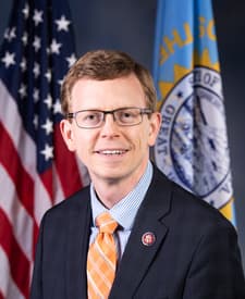
Senators
The state's senators today, or on the last day of these boundaries for an older plan.
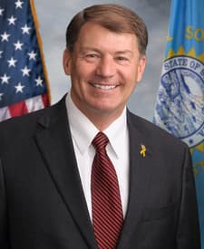 Mike RoundsR-SD
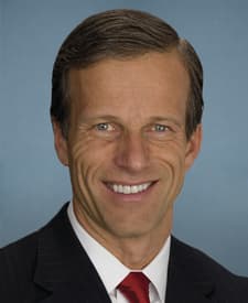 John ThuneR-SD
Counties
Share of the district's residents living in each county, and share of the county's residents living in the district (2020 census tracts weighted by their overlap).
- Minnehaha County22% of the district · 100% of the county
- Pennington County13% of the district · 100% of the county
- Lincoln County7.8% of the district · 100% of the county
- Brown County4.2% of the district · 100% of the county
- Brookings County3.9% of the district · 100% of the county
- Meade County3.4% of the district · 100% of the county
- Codington County3.2% of the district · 100% of the county
- Lawrence County3.0% of the district · 100% of the county
- Yankton County2.6% of the district · 100% of the county
- Davison County2.2% of the district · 100% of the county
- Beadle County2.1% of the district · 100% of the county
- Hughes County1.9% of the district · 100% of the county
- Union County1.9% of the district · 100% of the county
- Clay County1.7% of the district · 100% of the county
- Oglala Lakota County1.5% of the district · 100% of the county
- Lake County1.2% of the district · 100% of the county
- Butte County1.2% of the district · 100% of the county
- Roberts County1.1% of the district · 100% of the county
- Charles Mix County1.0% of the district · 100% of the county
- Todd County1.0% of the district · 100% of the county
- Custer County1.0% of the district · 100% of the county
- Turner County1.0% of the district · 100% of the county
- Grant County0.8% of the district · 100% of the county
- Hutchinson County0.8% of the district · 100% of the county
- Fall River County0.8% of the district · 100% of the county
- Bon Homme County0.8% of the district · 100% of the county
- Moody County0.7% of the district · 100% of the county
- Hamlin County0.7% of the district · 100% of the county
- Spink County0.7% of the district · 100% of the county
- McCook County0.6% of the district · 100% of the county
- Tripp County0.6% of the district · 100% of the county
- Day County0.6% of the district · 100% of the county
- Brule County0.6% of the district · 100% of the county
- Walworth County0.6% of the district · 100% of the county
- Kingsbury County0.6% of the district · 100% of the county
- Dewey County0.6% of the district · 100% of the county
- Marshall County0.5% of the district · 100% of the county
- Deuel County0.5% of the district · 100% of the county
- Edmunds County0.4% of the district · 100% of the county
- Gregory County0.4% of the district · 100% of the county
- Clark County0.4% of the district · 100% of the county
- Corson County0.4% of the district · 100% of the county
- Lyman County0.4% of the district · 100% of the county
- Hanson County0.4% of the district · 100% of the county
- Bennett County0.4% of the district · 100% of the county
- Hand County0.3% of the district · 100% of the county
- Stanley County0.3% of the district · 100% of the county
- Perkins County0.3% of the district · 100% of the county
- Douglas County0.3% of the district · 100% of the county
- Jackson County0.3% of the district · 100% of the county
- Aurora County0.3% of the district · 100% of the county
- Potter County0.3% of the district · 100% of the county
- Sanborn County0.3% of the district · 100% of the county
- Ziebach County0.3% of the district · 100% of the county
- Miner County0.3% of the district · 100% of the county
- McPherson County0.2% of the district · 100% of the county
- Faulk County0.2% of the district · 100% of the county
- Mellette County0.2% of the district · 100% of the county
- Buffalo County0.2% of the district · 100% of the county
- Jerauld County0.2% of the district · 100% of the county
- Haakon County0.2% of the district · 100% of the county
- Campbell County0.2% of the district · 100% of the county
- Sully County0.2% of the district · 100% of the county
- Hyde County0.1% of the district · 100% of the county
- Harding County0.1% of the district · 100% of the county
- Jones County0.1% of the district · 100% of the county
Federal contracts
Contract obligations attributed to the district by each action's county and its award's ZIP code (land shares through census tracts); an estimate where ZIP codes cross district lines.
- Obligations · FY2026
- $710.5M
- Per resident
- $783
- Rank in South Dakota
- —
- Contract actions
- 4,449
- New awards: 2,146
By fiscal year
- 711.5MFY2017
- 765.2MFY2018
- 941.1MFY2019
- 979MFY2020
- 623.6MFY2021
- 1.2BFY2022
- 1BFY2023
- 1.3BFY2024
- 804.3MFY2025
- 710.5MFY2026
Top buyers
- Department of the Army$205.3M29%Department of Defense
- Indian Health Service$120.7M17%Department of Health and Human Services
- Department of Veterans Affairs$103.2M15%
- U.S. Geological Survey$79.7M11%Department of the Interior
- Department of the Air Force$38.3M5.4%Department of Defense
- Defense Logistics Agency$24.8M3.5%Department of Defense
- Forest Service$17.3M2.4%Department of Agriculture
- Department of the Interior
Top recipients
- KBR WYLE SERVICES, LLC$70.6M9.9%53 awards
- STERLING COMPUTERS CORPORATION$50.5M7.1%195 awards
- CONTI FEDERAL SERVICES, LLC$42.6M6.0%7 awards
- FEDERAL CONTRACTING INC$40.7M5.7%6 awards
- BLACK HILLS SERVICE COMPANY, LLC$33M4.6%14 awards
- BL HARBERT INTERNATIONAL LLC$31.1M4.4%1 award
- TRIBAL HEALTH, LLC$26.1M3.7%16 awards
- L.S. BLACK CONSTRUCTORS, LLC$22.1M3.1%1 award
- LACREEK DEVELOPMENT CORP$21.9M3.1%50 awards
- VRC METAL SYSTEMS, LLC$20.4M2.9%6 awards
Other boundaries
District lines change between plans; each plan keeps its own page.
Sources and method
Every figure on this page traces to these records.
- Congressional district boundaries and relationship files (U.S. Census Bureau)U.S. Census Bureau, Cartographic Boundary Files (congressional districts) and 2020 relationship files · release cd116+cd118+cd119 · loaded Oct 3, 2026 · license: Public domain (U.S. Government work, 17 U.S.C. § 105)
- Members of Congress, their terms, committees and identifiers (The @unitedstates project (from the Biographical Directory of the U.S. Congress, the House and the Senate))unitedstates/congress-legislators: legislators, committees and current committee membership · data current to Oct 3, 2026 · loaded Oct 3, 2026 · license: CC0 1.0 (public domain dedication)
- ZIP code (ZCTA) to congressional district crosswalk (U.S. Census Bureau)U.S. Census Bureau, 2020 relationship files (ZCTAs, tracts and congressional districts); shares computed by Analisa · release 2020 · loaded Oct 3, 2026 · license: Public domain (U.S. Government work, 17 U.S.C. § 105)
- Federal contract transactions (Federal Procurement Data System) (U.S. Department of the Treasury, USAspending.gov)USAspending.gov, prime award contract transactions (FPDS) · data current to Oct 3, 2026 · loaded Oct 3, 2026 · license: Public domain (U.S. Government work, 17 U.S.C. § 105)
- Money and votes are shown side by side; neither explains the other.