Congressional district · Boundaries of the 119th Congress
Wyoming (at large)
Wyoming (at large) has 582,397 residents on 97,089 mi² of land. It is represented by Harriet M. Hageman (R-WY). Federal contract obligations attributed to it reached $637.8M in FY2026.
- Residents
- 582,397
- Land area
- 97,089 mi²
- Counties
- 23
- Representative
- Harriet M. Hageman
Members for this district
Members who held this seat while these boundaries were in force, newest first.

Senators
The state's senators today, or on the last day of these boundaries for an older plan.
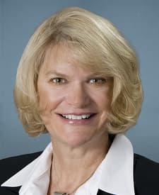
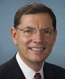 John BarrassoR-WY
Counties
Share of the district's residents living in each county, and share of the county's residents living in the district (2020 census tracts weighted by their overlap).
- Laramie County17% of the district · 100% of the county
- Natrona County14% of the district · 100% of the county
- Campbell County8.1% of the district · 100% of the county
- Sweetwater County7.1% of the district · 100% of the county
- Fremont County6.8% of the district · 100% of the county
- Albany County6.6% of the district · 100% of the county
- Sheridan County5.5% of the district · 100% of the county
- Park County5.2% of the district · 100% of the county
- Teton County4.0% of the district · 100% of the county
- Uinta County3.5% of the district · 100% of the county
- Lincoln County3.5% of the district · 100% of the county
- Carbon County2.5% of the district · 100% of the county
- Converse County2.4% of the district · 100% of the county
- Goshen County2.2% of the district · 100% of the county
- Big Horn County2.0% of the district · 100% of the county
- Sublette County1.5% of the district · 100% of the county
- Johnson County1.5% of the district · 100% of the county
- Platte County1.5% of the district · 100% of the county
- Washakie County1.3% of the district · 100% of the county
- Crook County1.3% of the district · 100% of the county
- Weston County1.2% of the district · 100% of the county
- Hot Springs County0.8% of the district · 100% of the county
- Niobrara County0.4% of the district · 100% of the county
Federal contracts
Contract obligations attributed to the district by each action's county and its award's ZIP code (land shares through census tracts); an estimate where ZIP codes cross district lines.
- Obligations · FY2026
- $637.8M
- Per resident
- $1,095
- Rank in Wyoming
- —
- Contract actions
- 3,636
- New awards: 2,177
By fiscal year
- 287.3MFY2017
- 470.3MFY2018
- 469.9MFY2019
- 386.4MFY2020
- 389.6MFY2021
- 559.2MFY2022
- 470MFY2023
- 532.3MFY2024
- 497.4MFY2025
- 637.8MFY2026
Top buyers
- National Park Service$169.2M27%Department of the Interior
- Departmental Offices$136.2M21%Department of the Interior
- Department of Veterans Affairs$85.4M13%
- Department of the Army$55.5M8.7%Department of Defense
- Department of the Air Force$39.2M6.1%Department of Defense
- Federal Highway Administration$38.9M6.1%Department of Transportation
- Forest Service$38.4M6.0%Department of Agriculture
- Federal Acquisition Service$26.8M4.2%General Services Administration
Top recipients
- RECORD STEEL AND CONSTRUCTION, INC.$129.8M20%2 awards
- G.S.E. CONSTRUCTION COMPANY, INC.$109.5M17%1 award
- THE ARMORED GROUP LLC$26.4M4.1%1 award
- BRIDGER RICHARD JV LLC$25.7M4.0%2 awards
- AECOM + TETRA TECH JOINT VENTURE$23.6M3.7%1 award
- OFTEDAL CONSTRUCTION, INC.$21.9M3.4%2 awards
- TRANS AERO LLC$12.1M1.9%39 awards
- PARAMOUNT CONSTRUCTION GROUP, LLC$11.8M1.8%2 awards
- HENSEL PHELPS CONSTRUCTION CO$11.5M1.8%1 award
- MISSOURI RIVER CONTRACTORS, LLC$10.7M1.7%3 awards
Other boundaries
District lines change between plans; each plan keeps its own page.
Sources and method
Every figure on this page traces to these records.
- Congressional district boundaries and relationship files (U.S. Census Bureau)U.S. Census Bureau, Cartographic Boundary Files (congressional districts) and 2020 relationship files; 2026 lines (120th Congress): block equivalency files, TIGER/Line district shapes and 2020 Census block populations (DHC), combined by Analisa · release cd116+cd118+cd119+cd120 · loaded Oct 16, 2026 · license: Public domain (U.S. Government work, 17 U.S.C. § 105)
- Members of Congress, their terms, committees and identifiers (The @unitedstates project (from the Biographical Directory of the U.S. Congress, the House and the Senate))unitedstates/congress-legislators: legislators, committees and current committee membership · data current to Sep 24, 2026 · loaded Oct 13, 2026 · license: CC0 1.0 (public domain dedication)
- ZIP code (ZCTA) to congressional district crosswalk (U.S. Census Bureau)U.S. Census Bureau, 2020 relationship files (ZCTAs, tracts, blocks and congressional districts) and 120th Congress block equivalency files; shares computed by Analisa · release 2020 · loaded Oct 13, 2026 · license: Public domain (U.S. Government work, 17 U.S.C. § 105)
- Federal contract transactions (Federal Procurement Data System) (U.S. Department of the Treasury, USAspending.gov)USAspending.gov, prime award contract transactions (FPDS) · data current to Nov 22, 2026 · loaded Nov 22, 2026 · license: Public domain (U.S. Government work, 17 U.S.C. § 105)
- Money and votes are shown side by side; neither explains the other.